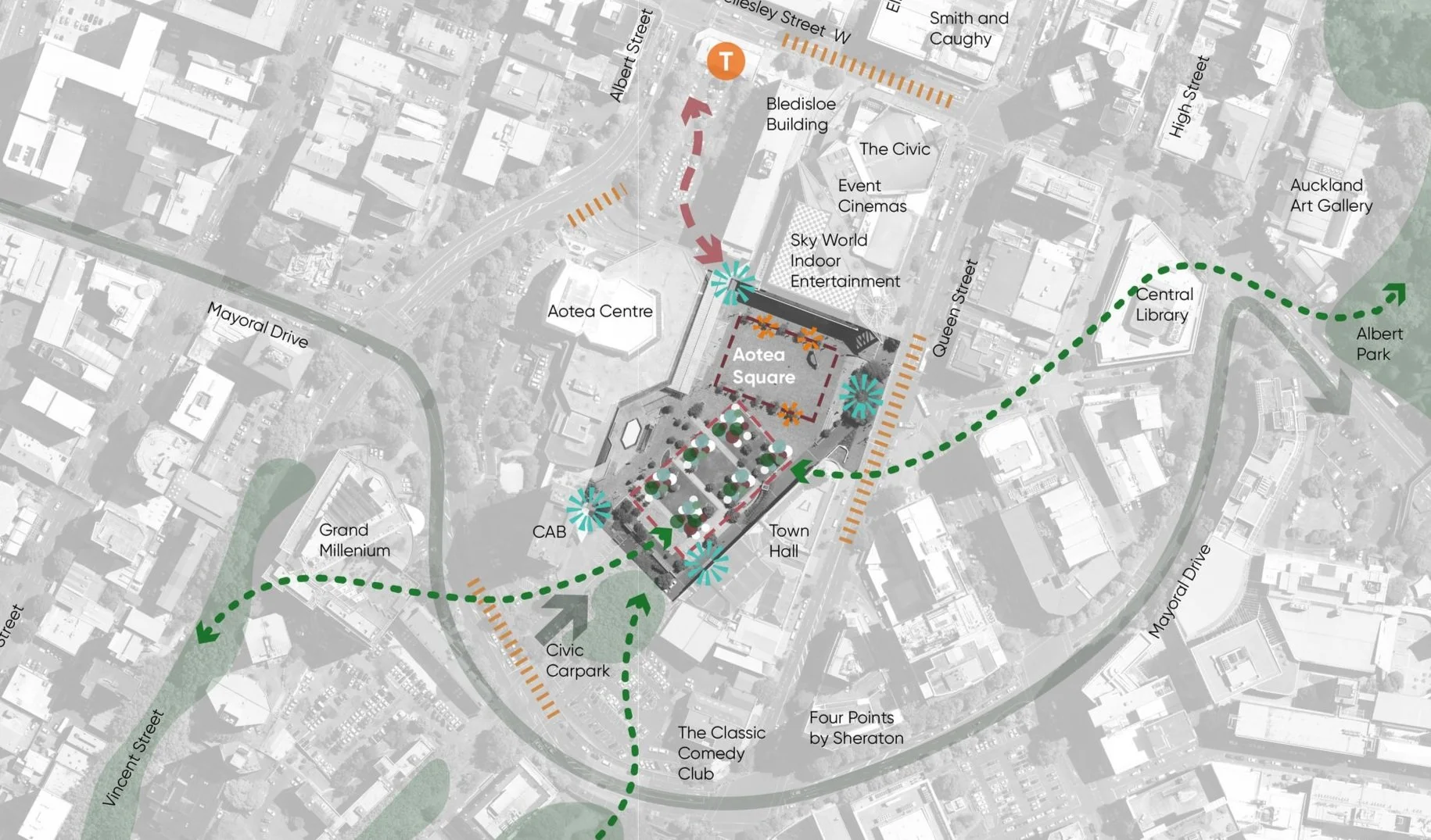
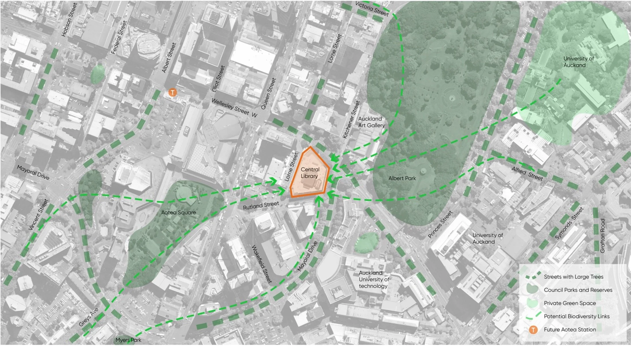
Aotea Centre Nature-based Solutions Feasibility Study
Te Huruhi School Mara Concept
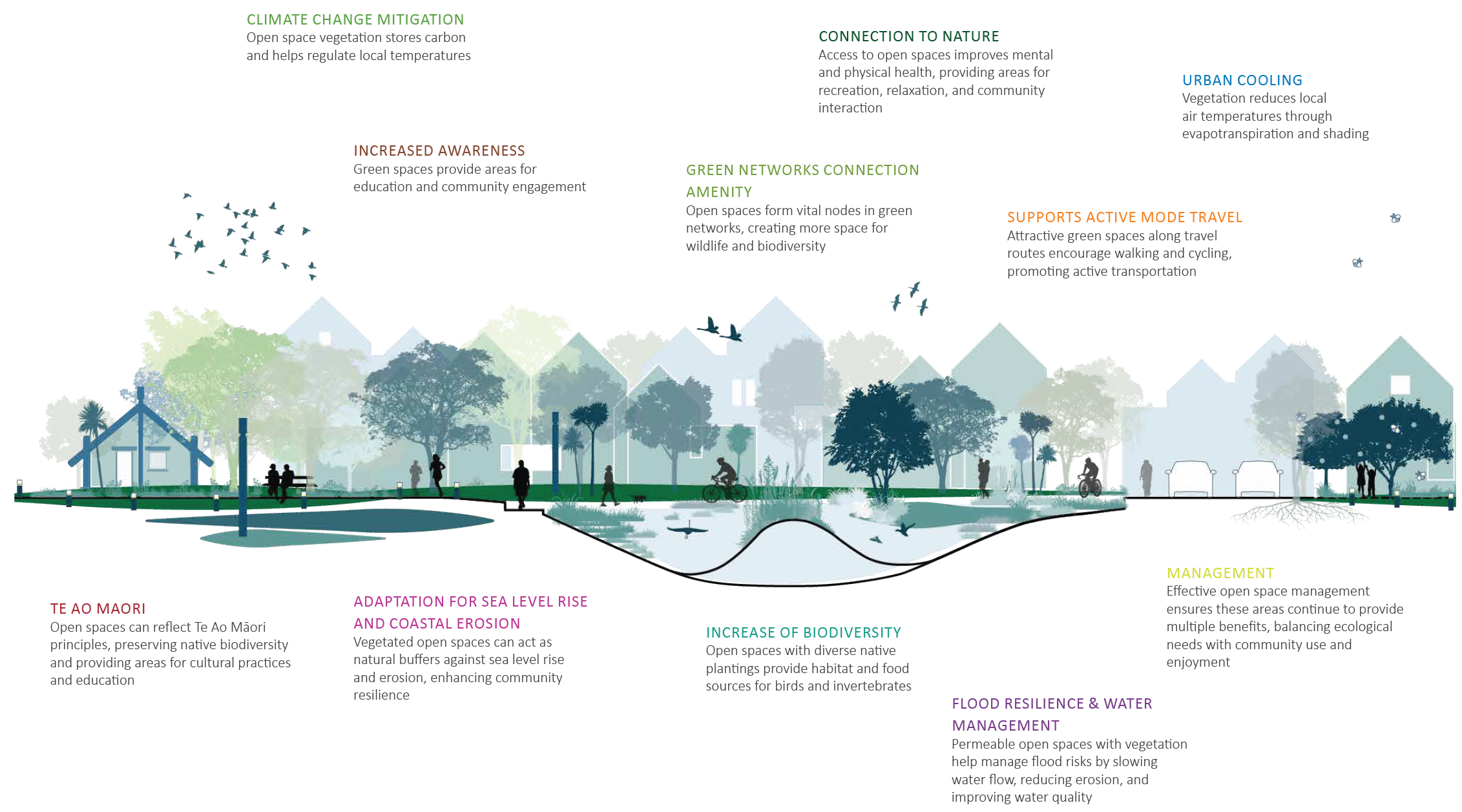
Kāinga Ora Open Space Guidelines
Ngahere Framework
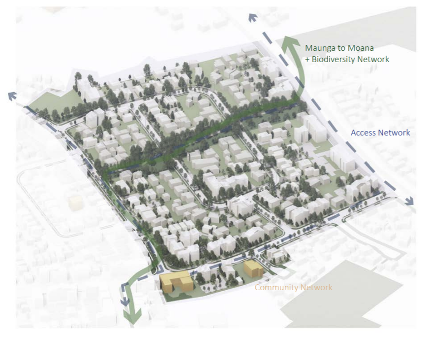
Te Ararata b Stage 2A Tree Infrastructure Plan
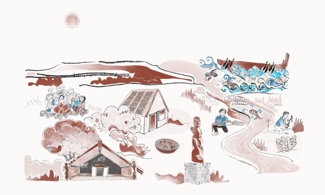
Te Ahiwaru Ahi Kaa Framework
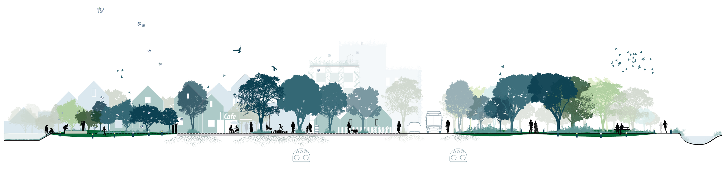
Street Typologies for People and Nature
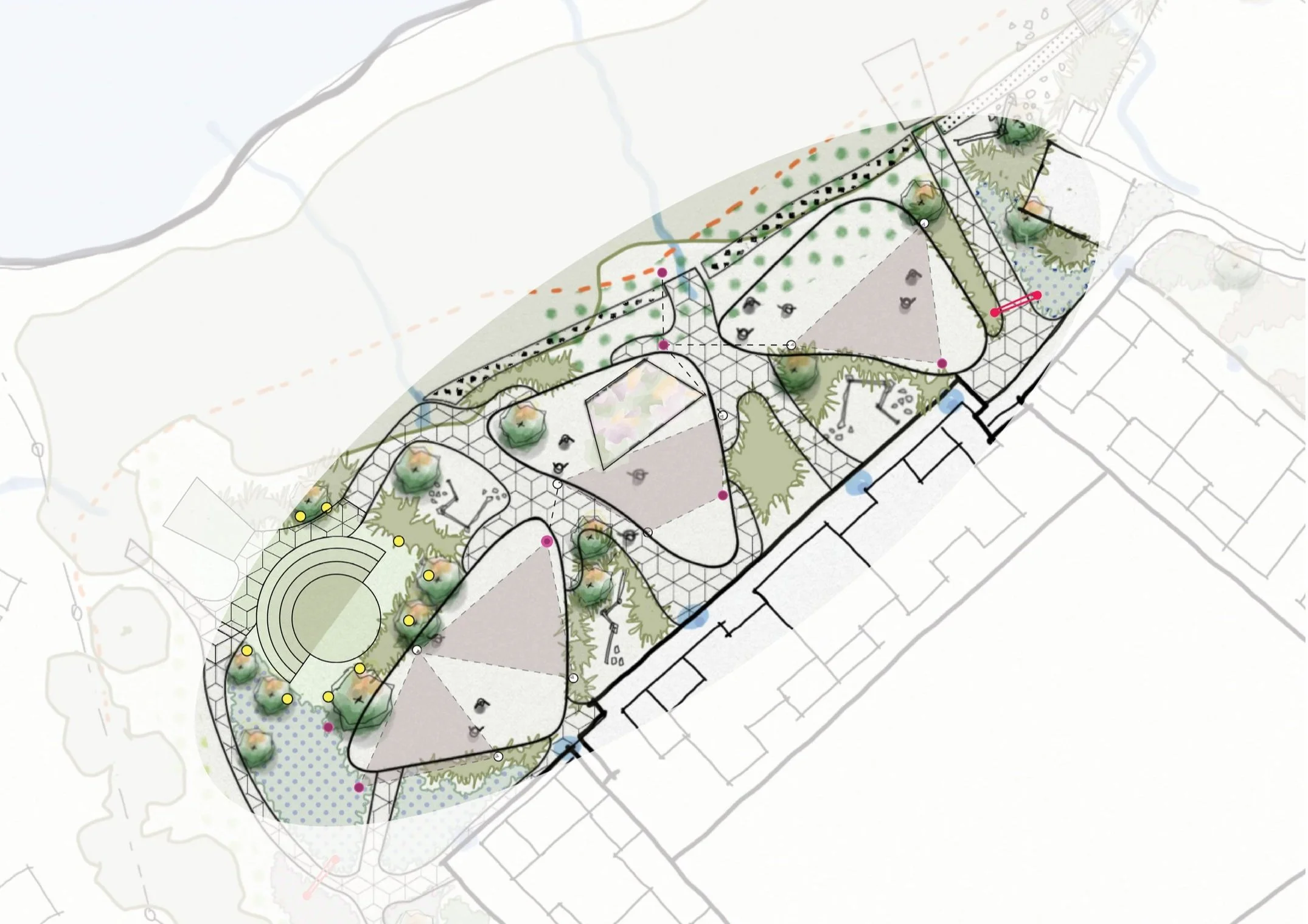
Pukekawa Auckland Domain Planting Strategy
Tāmaki Makaurau Enhanced Tree Planting Project
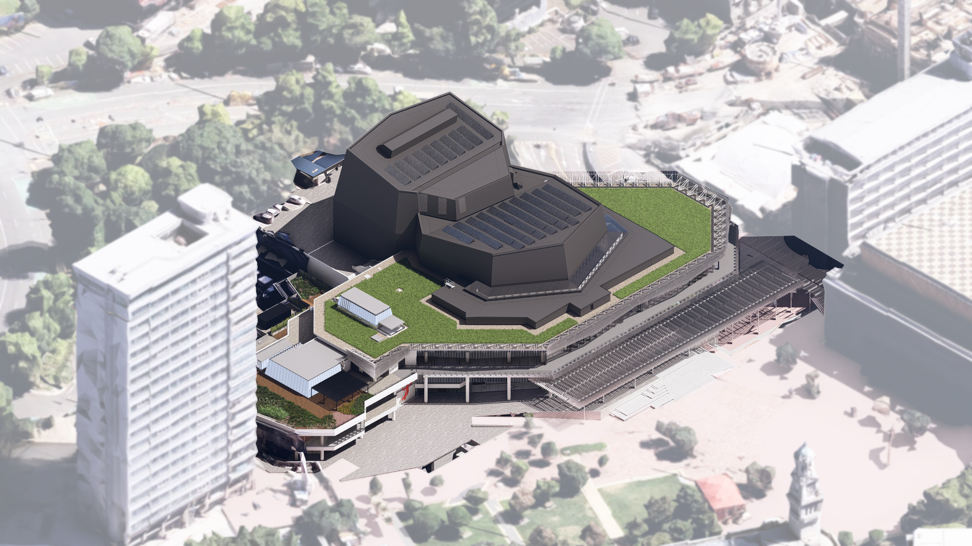
Auckland Central Library Living Roof Monitoring

Goodland Coastal Farm AEE + Urban Design Guidelines